

If you’ve spent any real time spinning the dial on UHF or VHF, you know the golden rule: line-of-sight dictates your day. Normally, those waves act like a laser beam shooting straight out toward the horizon, and because the Earth curves away, they eventually head right out into space. Your range is strictly bound by your antenna height, the local terrain, and the buildings around you.
But every once in a while, Mother Nature decides to break her own rules.
You key up and suddenly you’re hearing a crystal-clear simplex transmission from three states over. Or worse, you key up your local repeater and accidentally trip a machine with the same tone hundreds of miles away. Welcome to Repeater Roulette, my friends. You’ve just stumbled into Tropospheric Ducting (or “Tropo”), one of the most exciting atmospheric phenomena an operator can experience.
Let’s break down exactly how this phenomenon works, what weather shifts cause it, and how you can actively hunt these openings like a seasoned pro.
Bending the Line-of-Sight Rules
Whether you’re a GMRS operator chatting on UHF frequencies around 462 to 467 MHz or a Ham scanning the 2-meter 144 MHz and 70cm bands, we all share the same baseline reality. Under standard conditions, our frequencies are strictly limited by the horizon, cutting right through the upper atmosphere and disappearing into the cosmos.
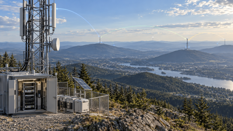
Tropospheric ducting completely rewrites this script for both worlds. When specific weather patterns align, they create a temporary atmospheric tunnel in the lower layer of our skies, the troposphere. Instead of escaping upward, your radio signal gets trapped, bouncing along this atmospheric boundary and bending with the natural curvature of the Earth.
Suddenly, your standard local coverage explodes, reaching 100, 200, or even 500+ miles. The magic catch for any operator is that it’s entirely temporary. A solid duct might last for a few hours, or if you’re lucky, a couple of days, before vanishing back into the ether.
Perfect Weather Recipe for RF Tunnels
So, how exactly does an invisible tunnel form in the sky? Radio waves behave remarkably like light. When a signal transitions from an air layer of one density into another, it changes speed and refracts. Normally, air gets colder the higher you climb, and air density changes gradually. This standard atmosphere gives us a slight, natural downward curve that extends our radio horizon slightly beyond our visual horizon.
But when a severe weather event flips the atmosphere, a severe drop in refractivity occurs overhead. The top of your radio wave hits this boundary and accelerates dramatically, while the bottom of the wave remains slow. This massive velocity difference forces the wave front to hook sharply downward. As the wave hits the ground, it reflects back up toward the inversion layer, creating a natural waveguide, like a coaxial cable in the sky.
This radio-bending miracle requires two critical meteorologic ingredients: a temperature inversion and a sudden humidity drop. A temperature inversion occurs when a layer of warm, dry air settles right on top of a layer of cool, moist air, creating a distinct atmospheric ceiling. At that exact same boundary layer, you need a sharp drop in moisture. When cool, moist air sits below and warm, dry air sits above, that exact boundary becomes the duct.
The Weather Engines Driving the Duct
These atmospheric tunnels are triggered by very specific macro-level weather conditions that rearrange our air layers. The most common engine is the High-Pressure System, where sinking air compresses and dries out as it falls. When it settles over cool, stagnant surface air, it builds massive, stable ducts that can span multiple states and last for days. On clear, calm nights, we often experience High-Radiation Cooling. The ground quickly radiates its heat away, chilling the air right above it while the air a few hundred feet up stays warm. These nocturnal ducts peak around dawn and “burn off” shortly after sunrise.
Frontal Boundaries also create rapid atmospheric changes. Fast-moving warm fronts override colder air to build sloped inversions ahead of the storm system, while cold fronts wedge heavy air underneath warm masses for short, erratic signal bursts. Along coastlines, Marine and Lake-Effect Advection takes over in late spring; warm land air blows horizontally out over chilly, hyper-moist bodies of water, creating intense, long-lasting coastal inversions. Similarly, Downslope Winds (like Chinooks or Santa Anas) rush down mountain ranges and warm up rapidly via compression, sliding over pre-existing pools of cool, damp valley air. Finally, right at the sea-air interface, Evaporation Ducts create ultra-shallow moisture drops. While these are usually too thin to trap lower-frequency VHF waves, they act as permanent highways for higher UHF and microwave frequencies.
Depending on how these weather engines collide, the resulting tunnel forms at different altitudes. Surface Ducts form right at ground level, meaning everyone can play—operators with handhelds, mobile rigs, and modest base stations can all get in on the long-distance action. Elevated Ducts, however, form high overhead, typically between 2,000 and 5,000 feet. These channels primarily favor mountaintop repeaters, tall commercial towers, and operators with exceptionally high antennas, often skipping right over operators on the valley floor.
Hunting Tropospheric Ducts Without Guessing
You don’t have to sit blindly at your desk spinning dials hoping for a miracle. By combining modern forecasting tools with a few old-school monitoring tricks, you can actively hunt these openings with precision.
Your first move should always be checking a daily tropo forecast map. Dull blue and grey colors indicate normal, line-of-sight conditions, while bright yellow and orange point to enhanced propagation. When you see deep red or magenta bands, strong ducting is actively occurring. To track this in real-time, you should bookmark two essential tools. First, use William Hepburn’s VHF/UHF Tropospheric Ducting Forecast to see mapped predictions of where these atmospheric tunnels are forming. Second, keep an eye on the VHF DX View Real-Time Map to see live, operator-reported contacts breaking the distance barriers as they happen. If a red band on the forecast connects your location to another state, the radio highway is open.
Once the maps look promising, use the NOAA Weather Radio early warning system. Cycle through the seven NWR channels sitting between 162.400 to 162.550 MHz. Because these weather frequencies sit right in the sweet spot below our GMRS channels and the 2-meter Ham band, they react to tropospheric ducting the exact same way. If you suddenly hear a crystal-clear NOAA broadcast from a transmitter two states away that is normally buried in static, consider it the ultimate green light for both GMRS and Ham operators to start scanning the bands.
When you are actively inside an opening, your radio will start displaying a few unmistakable signs. Watch for “ghost” repeater tails, which are faint, unfamiliar courtesy tones or trailing static tails that appear after you unkey. You will also start hearing unfamiliar voices chatting on your local frequencies, throwing out city names, landmarks, or call signs from hundreds of miles away. Most excitingly, look for extreme S-meter bounce; a weak, distant station that usually registers as a barely audible whisper will suddenly jump up to a full, pin-the-needle signal.



The Sky Is Your Guide
Tropospheric ducting reminds us that we don’t always need massive amplifiers, high-power setups, or satellite networks to achieve incredible distance. Sometimes, we just need to know how to read the weather. By mastering the quick workflow of checking your forecast map, validating with a NOAA check, and scanning your frequencies, you can catch the DX wave before it disappears.
Keep your eyes on the weather fronts, keep your antennas high, and the next time you hear a strange voice booming into your local repeater from three states over, don’t adjust your squelch. Grab the mic, throw your call sign out, and enjoy the ride.
Know the air. Use it wisely. Stay safe. See you on the airwaves!
Purchase Guide
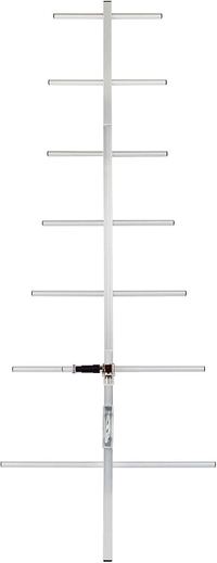
TWAYRDIO YG07
11dBi UHF 7-Element Yagi Antenna